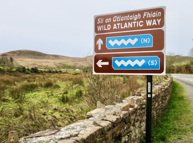
The Wild Atlantic Way is regarded as the “world’s longest defined coastal touring route”. Stretching 2,500km from County Donegal in Ireland’s far north to County Cork in the south, the Wild Atlantic Way is one of the most epic road trips I’ve ever done. Along the way, I was simply entranced by green rolling hills for which Ireland is famous, impressive mountains and tranquil lakes, daunting cliffs with its pounding surf, colourful towns, historic castles and abbeys, and rugged islands. The ever-changing weather colluded with the dramatic landscapes to create awe-inspiring scenes around every bend!

Breathtaking scenery and fabulous food!
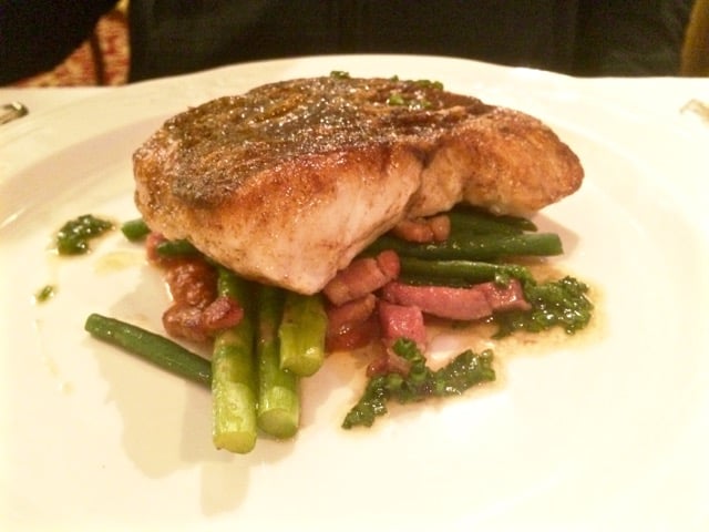
I also quickly discovered that the Wild Atlantic Way isn’t only about breathtaking scenery, it could also be called the “world’s longest foodie touring route”! The ‘farm-to-table’ concept is common practice here and I feasted on the freshest salmon, lamb, scallops and oysters.
In between driving and stuffing myself, I explored charming villages and towns, hiked along coastal paths and visited ancient ruins. I was simply amazed by the sheer variety of landscapes, foodie experiences and historic gems I encountered. Follow me on my Wild Atlantic Way road trip!
My epic Wild Atlantic Way road trip
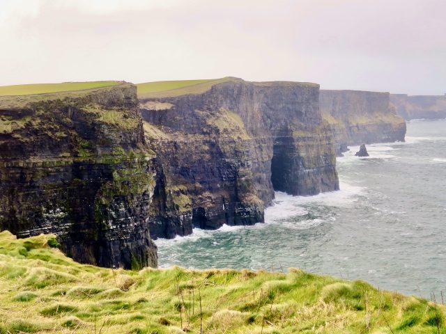
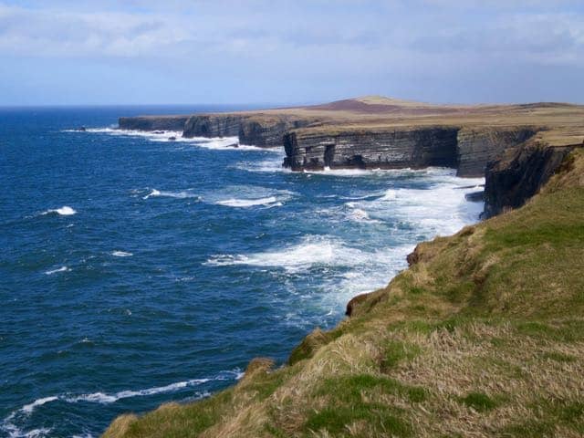
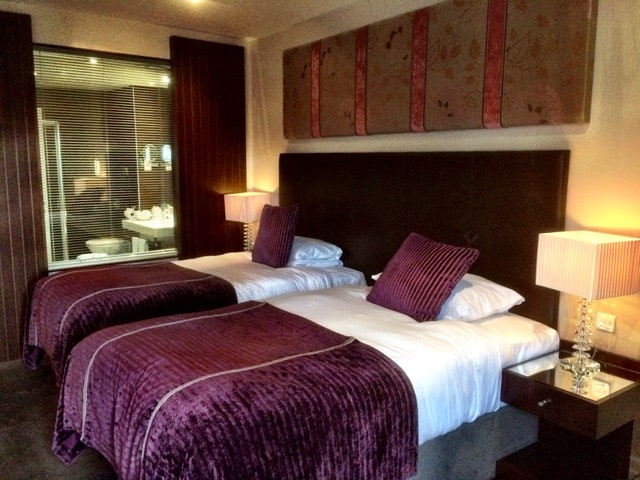
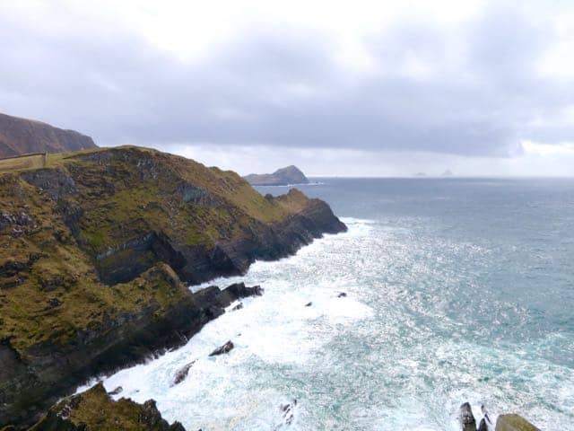
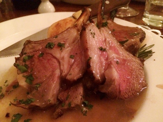
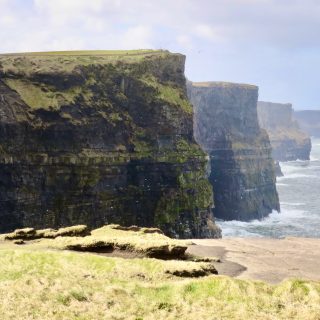
I didn’t do the entire route but approximately a third of the 2,500km stretch in five days. After driving across from Dublin (read about things to see in Dublin), my Wild Atlantic Way road trip kicked off in the village of Lisdoonvarna, southwest of Galway. Lisdoonvarna is famous for its natural hot springs and annual Matchmaking Festival in September. The festival is reputedly Europe’s largest singles festival and boasts a week of music, dancing and craic (good ol’ Irish fun!). I stayed the night at Sheedy’s Country House Hotel. For dinner, I was treated to some of the most tender lamb racks I’ve ever had! Just a short drive from Lisdoonvarna are one of Ireland’s prime tourist attractions: the Cliffs of Moher. The cliffs are an astounding sight and a must-see on the Wild Atlantic Way.
From the Cliffs of Moher to Loop Head
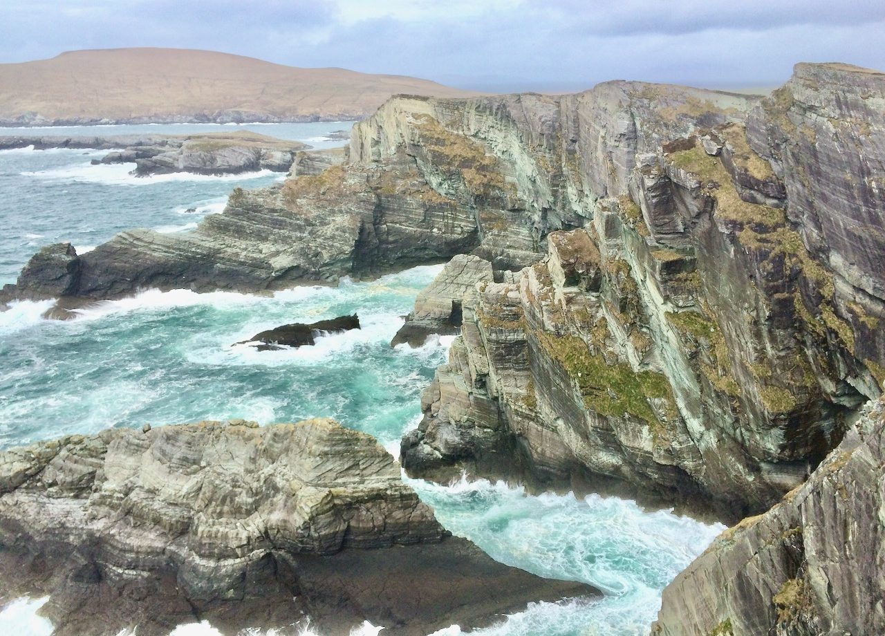
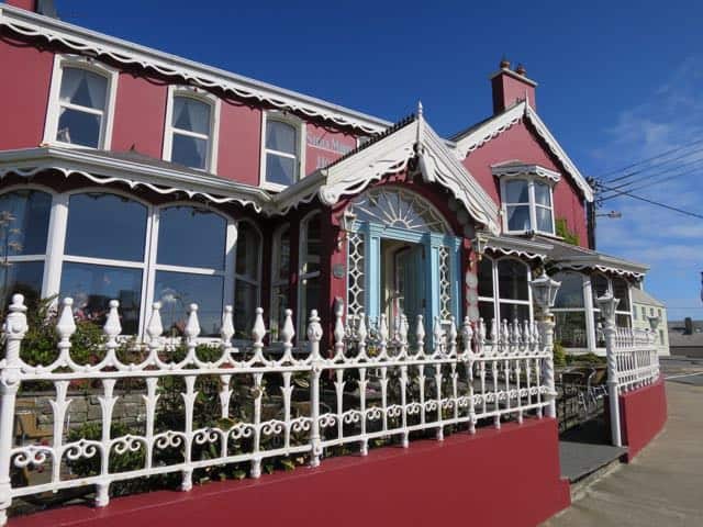
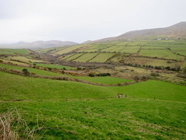
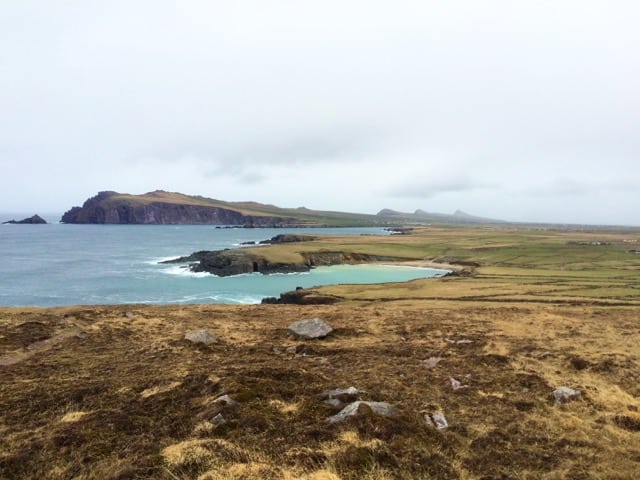
From the Cliffs, I headed southward along the scenic N67 road to Kilkee, the gateway to the Loop Head peninsula. Kilkee is a small seaside town with quaint Victorian houses and a broad crescent-shaped beach. I dropped by the lovely Stella Maris Hotel for lunch before continuing to Loop Head. Heeding the advice of the staff at Stella Maris, I stopped at the rock pools and went for a beautiful walk along the cliffs just south of Kilkee before proceeding to Loop Head. The thunderous waves and the rocky coast were truly a sight to behold!
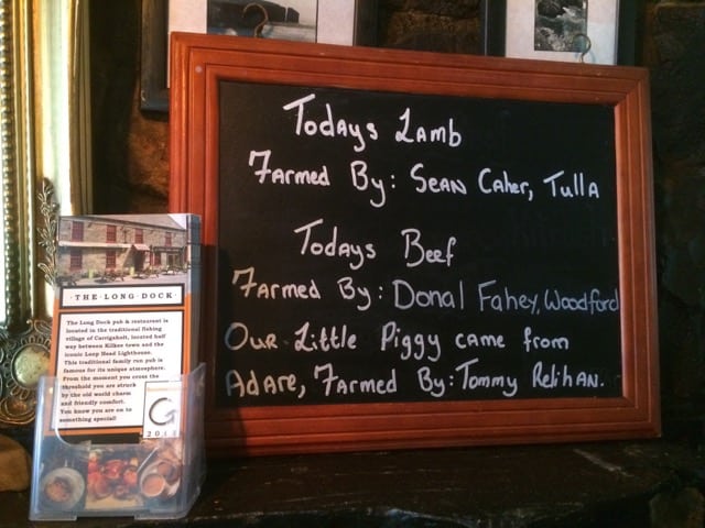
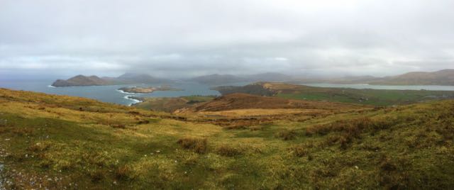
The drive around Loop Head took me past gorgeous meadows and sleepy villages. I made three stops along the way: the Loop Head Lighthouse at the very tip of the peninsula, the Bridges of Ross to see the natural sea arches and Carrigaholt, a small fishing village famous for its annual Oyster Festival (tip: drop by The Long Dock Pub in Carrigaholt for a pint and fabulous food!).
County Kerry
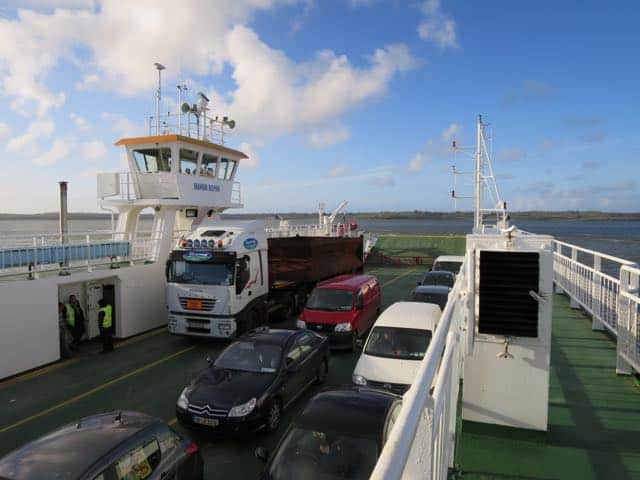
I then continued past the colourful town of Kilrush to Killimer where I boarded the Killimer – Tarbert Ferry across the Shannon Estuary to County Kerry. The ferry is the only vehicle ferry trip along the Wild Atlantic Way and on the 20-minute ride, if you’re lucky, you might spot some of the dolphins which make the estuary their home. I wasn’t very lucky that day. 😉
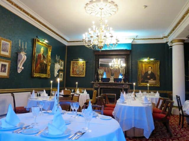
I continued my drive to Tralee, home of the famous Rose of Tralee Festival (in August each year), and arrived at my next accommodation: the Ballyseede Castle. I was quite excited (and a bit nervous) about staying at Ballyseede Castle. This castle has the reputation of being one of the most haunted castles in Ireland!
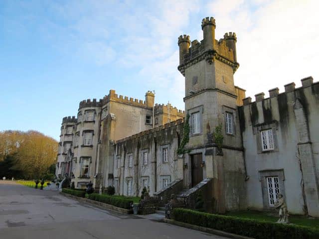
This 16th century castle sure looks the part on the outside but once you enter, you’ll be awed by its stately interior and gorgeous drawing rooms. My room was very spacious and had a view of the sprawling gardens. After a fabulous dinner at the restaurant, I went to bed and slept like a baby! No hint of a ghost anywhere.
Read about my travel ghost stories
Dingle Peninsula
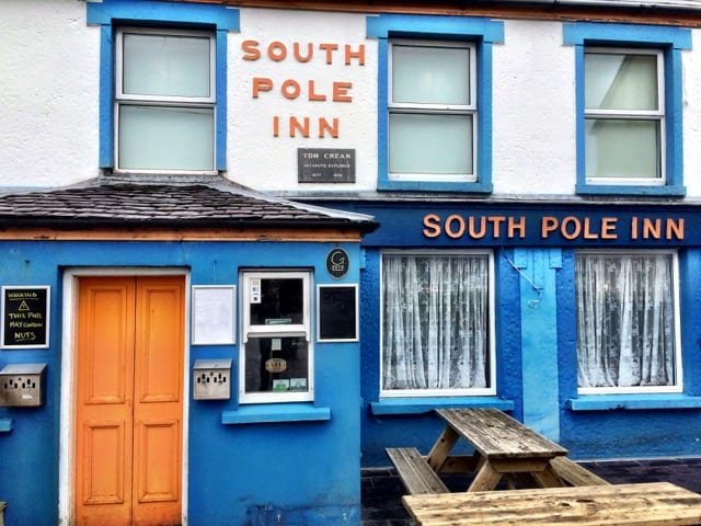
From Tralee, I drove south to Castlemaine where I continued westwards on the Dingle Peninsula, a wild and rugged region of spectacular landscapes. Driving along the R561 road, my first stop was the broad arc of sand at Inch before continuing inland to Annascaul, where I dropped by the South Pole Inn, which was opened by the famous Antarctic explorer Tom Crean in 1920.
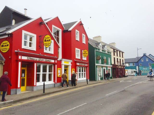
From here, I continued to Dingle, the main town on the peninsula, passing stunning mountain scenery along the way.
Dingle, with its harbour, brightly coloured houses, pubs and restaurants, is an absolutely delightful town.
The westernmost point of Europe
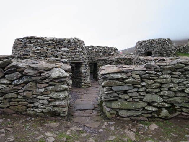
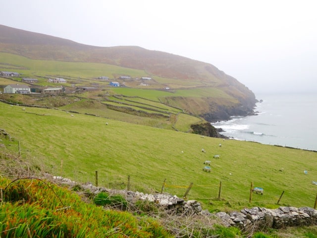
After a delicious fish-and-chips lunch, I continued on a ring road (in a clockwise direction) that brought me to the westernmost edge of Europe. The coastal scenery was simply breathtaking. I briefly stopped at an archeological site with centuries-old clocháin or beehive stone huts. There are various sites scattered around the peninsula, such as at Fahan, and it’s a fascinating experience to visit one of them.
I couldn’t take my eyes off of the scenery though. It rained intermittently, with cloudy and sunny spells in between, but this just added to the dramatic atmosphere.
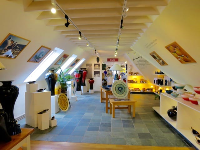
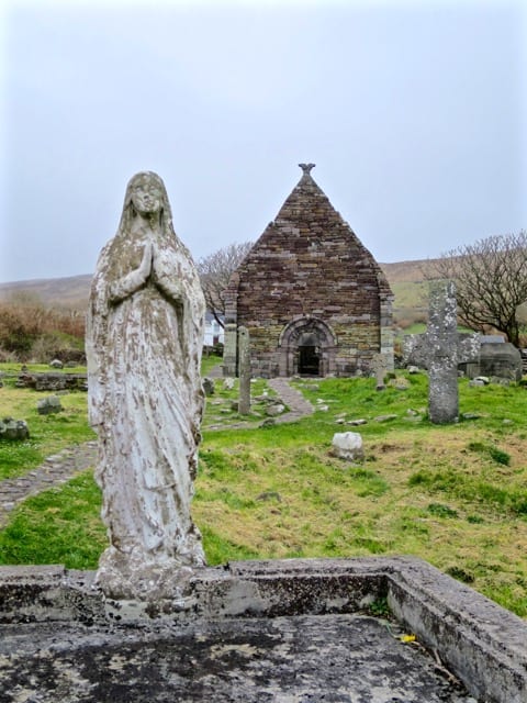
I made brief stops at the intriguing Blasket Centre (a museum that documents the lives of the community who lived on the remote Blasket Islands), the colourful Louis Mulcahy’s Pottery Centre, the Gallarus Oratory (a 1,200-year-old church) and the hauntingly beautiful 12th century Kilmalkedar Church, before returning to Dingle.
Connor Pass
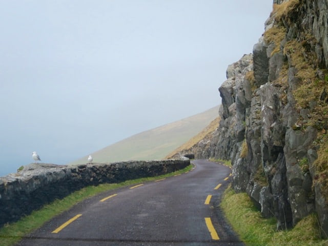
From Dingle, I continued inland towards the spectacular Connor Pass. The narrow road winds its way through the mountains connecting the peninsula’s southern and northern coasts, offering amazing vistas all around.
The circle route brought me back to Tralee and from here, I drove southeastwards to the charming town of Killarney. Nestled in a mountain valley at the edge of a gorgeous lake, Killarney is especially renowned for its beautiful parks, gardens and magnificent Gothic-Revival St. Mary’s Cathedral.
I stayed at The Ross Hotel in the heart of Killarney. With its plush, contemporary interior, The Ross Hotel sure formed a sharp contrast to my previous accommodation!
Ring of Kerry and the Skellig Ring
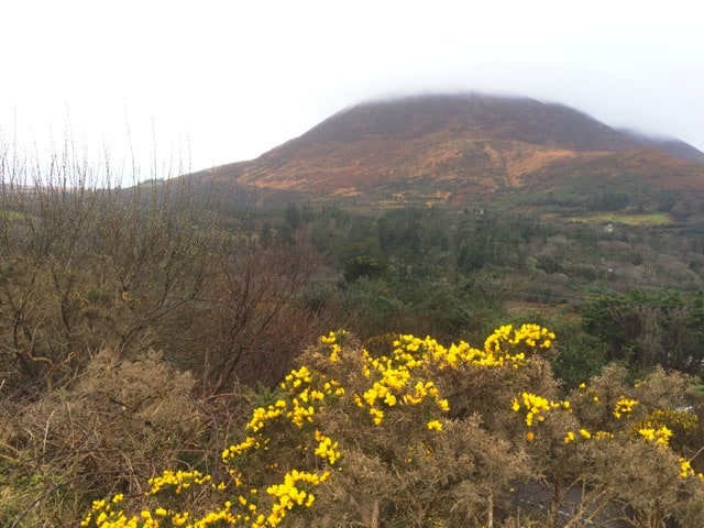
Out at the very edge of Europe, the Ring of Kerry and the smaller (but even more spectacular) Skellig Ring routes circle the Iveragh Peninsula. I decided to drive the Ring of Kerry in an anti-clockwise direction, starting out from Killarney to the picturesque town of Killorglin. From here, I continued along the north coast of the Iveragh Peninsula on the N70 road. The scenery along the way was just stunning: little coves, the large expanse of Dingle Bay, verdant meadows, and rugged, mist-shrouded mountains covered with flowering broom.
Valentia Island
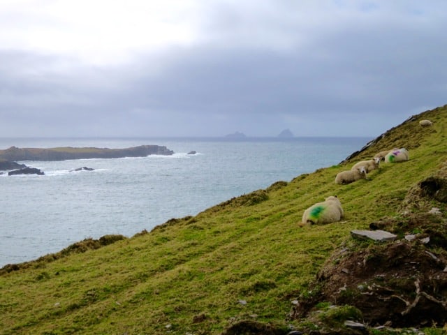
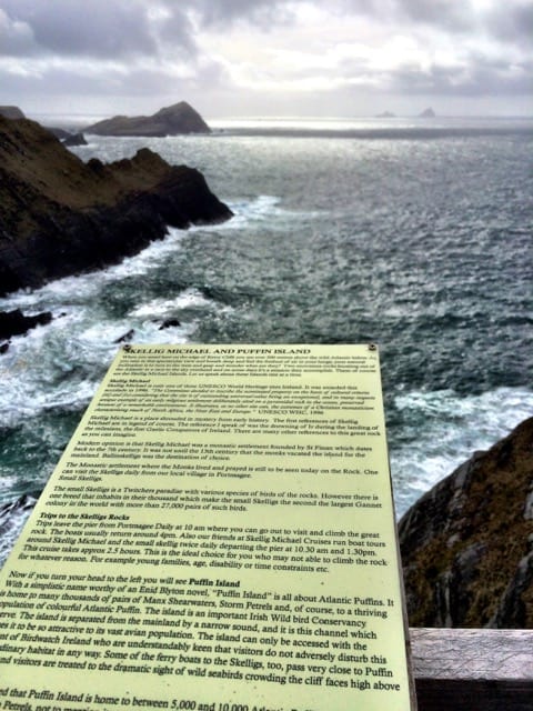
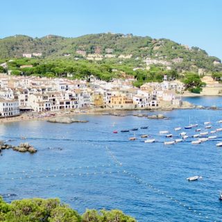
I turned off the N70 and continued along the R565 – the Skellig Ring – towards Portmagee, a lovely fishing town. At Portmagee, I crossed the bridge to Valentia Island for my first stop: the Skellig Experience Visitor Centre. This centre documents the history and geology of the Skellig Rocks (rocky outcrops crowned with awe-inspiring pinnacles just off the coast of the Iveragh Peninsula) and the community founded by Skellig monks who lived there for many centuries. The exhibits and video are a must-see in my book – I was bowled over by the sheer determination of the monks to establish a community on these inhospitable islands and how they survived there for so long. The historical and architectural legacy they left behind is astonishing.
The home of Luke Skywalker
The Skellig Rocks are a UNESCO World Heritage site and were prominently featured in the latest Star Wars movies as the home of Luke Skywalker and the Jedi Temple. They can be visited in the summer months – if you choose to join one of the boat tours to Skellig Michael, make sure you’re in good physical condition as you’ll have to climb hundreds of steep, rocky steps on the island! If you saw the Star Wars movies (Episode VII: The Force Awakens and Episode VIII: The Last Jedi), you’ll get a pretty good idea of the terrain of the islands.
From the Visitor Centre, I continued my drive around Valentia Island. A panoramic viewpoint atop a hill in the centre of the island offers amazing views of the hills and the craggy coast!
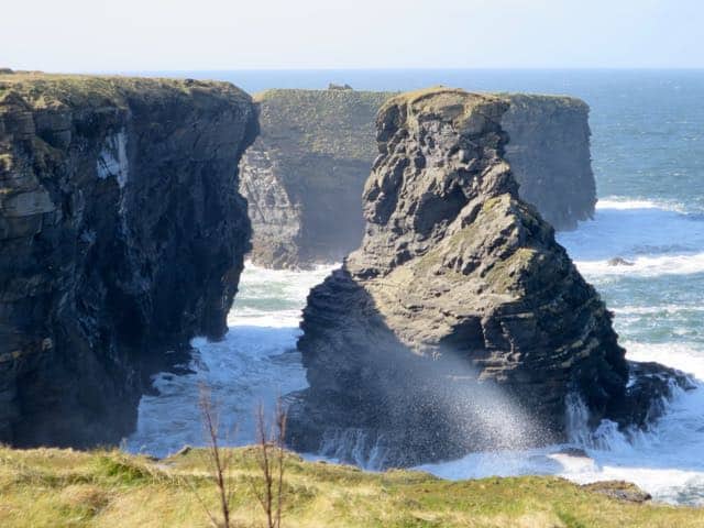
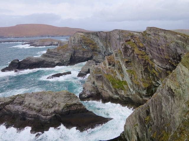
Kerry Cliffs
I arrived back in Portmagee, where I stopped at The Moorings for its delicious seafood chowder. After lunch, I followed the Skellig Ring road that wound its way along the coast and up into the mountains, stopping along the way to view the breathtaking Kerry Cliffs just southwest of Portmagee. To me, these cliffs personify the Wild Atlantic Way: wild, dramatic and jaw-droppingly spectacular!
I continued along the southern coast of the peninsula, where I stopped at several picturesque villages. Waterville was my first stop – look out for the Charlie Chaplin statue commemorating the time the comedian spent in this town. Other quick stops included Caherdaniel, Castlecove and Sneem. I soon arrived in the gorgeous town of Kenmare, a popular base for visitors exploring the Ring of Kerry or the Ring of Beara.
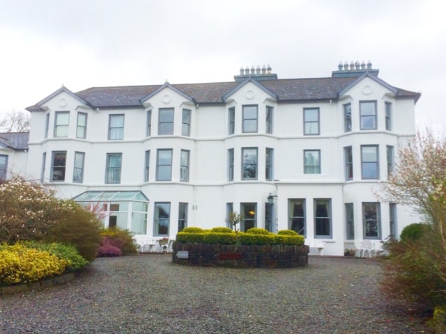
From Kenmare, I headed inland along the N71 road. It took me up into the mountains, past Gougane Barra Forest Park and down to the shores of Bantry Bay. The bay was my next overnight spot: the delightful Seaview House Hotel. Surrounded by expansive gardens, the hotel has spacious rooms, a terrific restaurant (the lamb rack is absolutely divine!) and the loveliest staff.
West Cork
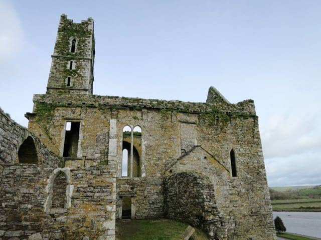
I continued along the N71 road passing stately villas and yacht harbours – there’s obviously lots of wealth in this part of Ireland. From the village of Ballydehop, I drove eastwards through the heart of West Cork (an area known as the gourmet capital of Ireland). Along the way, I passed villages such as Skibbereen and Clonakilty, and stopped at Timoleague. Perched on the edge of a sea inlet, this village is dominated by the haunting ruins of the 13th century Timoleague Abbey. Strolling around the abbey sure gave me goosebumps!
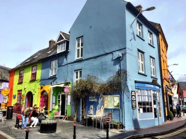
Colourful Kinsale
From here, I followed the road to the colourful town of Kinsale. Kinsale, with its little harbour, brightly-coloured houses and many restaurants, is absolutely gorgeous. After a stroll around town, I decided to have lunch at the lively Blue Haven restaurant. It was my last meal on the Wild Atlantic Way so I indulged myself on some terrific salmon and scallops.
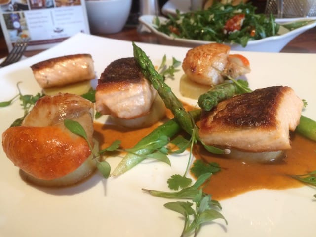
As I chewed on the juicy, tender scallops, I thought about this road trip and the amazing experiences I had. It sure was an epic drive full of spectacular vistas, fascinating historical monuments, fabulous food and wonderfully hospitable people. Would I do it again? Oh yes! If you’re looking for an epic road trip, look no further than the Wild Atlantic Way!
Note: I was hosted in Ireland by Tourism Ireland. As always, all views expressed above are mine and mine only.


[…] has its fair share of spooky places. During my Wild Atlantic Way road trip, I stayed a night at the Ballyseede Castle, which has the reputation of being one of the most […]
Thank you for your sharing your trip experience, certainly a great experience!
Tourism Index surveyed more than 6000 people and shows that 65% drove the wild atlantic way last year.
[…] In March, I was back in Dublin for a second set of seminars. This time, I added a few extra days to my stay and went on an unforgettable road trip to the Cliffs of Moher and along the Wild Atlantic Way! […]
[…] I slowly made my way back to the Visitor Centre, sneaking glimpses of the cliffs along the way, and treated myself to a hot chocolate. As I sipped on the rich chocolate, I couldn’t help but chuckle at the thought of how perfect this was: huge cliffs, thundering waves and gale-force winds! It made the experience so much more intense! This was my first stop on my road trip along the Wild Atlantic Way – the coastal road that winds its way along the Irish Atlantic coast – and what a spectacular appetiser it was! [Read about my road trip along the Wild Atlantic Way] […]
[…] Driving the Wild Atlantic Way in Ireland || by Keith from Velvet Escape […]
Thank you Alan for your comment. Guess I’ll have to return and do the Mayo bit! 🙂
Cheers,
Keith
Glad you enjoyed your visit to my country and enjoyed the Wild Atlantic Way. Be sure to come back to do the other half. I would agree with Derek – Mayo is the best (and I’m not from there!)
Very pretty, sure hope to make it over to Ireland one day …
Hi Derek,
Yes, I didn’t get to do the entire WAW. Hope to do the rest one day, from Galway and up north.
Thanks for your comment.
Cheers,
Keith
Thanks Selma!
You can almost feel the rawness of the Atlantic in these pics … the luxury meals and hotels along the way provide a tantalizing counterpoint to it as well!
A huge part of the Wild Atlantic Way was missed on this tour. My biased opinion the best place to visit is County Mayo. It has stunning scenery, the highest sea cliffs in Europe, The largest wilderness area in Europe – Nephin Wilderness, great coastal walks, beautiful mountains & best of all the people of this County – Derek Davidson – Walk West Ireland
Thanks Felipe! 🙂
Something like “around the world in 80 days” :-). Well done, I really enjoyed reading this one.