Seeing Paris from a plane window is always a treat. Not only is it easy to recognise some of the city’s most famous landmarks like the Eiffel Tower, the Arc de Triomphe and the Louvre, it’s also a great way to truly appreciate the beauty of Baron Haussmann’s stunning design of the city’s wide boulevards, epicentres and parks. On a recent flight from Amsterdam, the flight path took us directly over the heart of Paris. It was a partially cloudy day but the aerial views of Paris between the clouds were astounding.
Aerial views of Paris
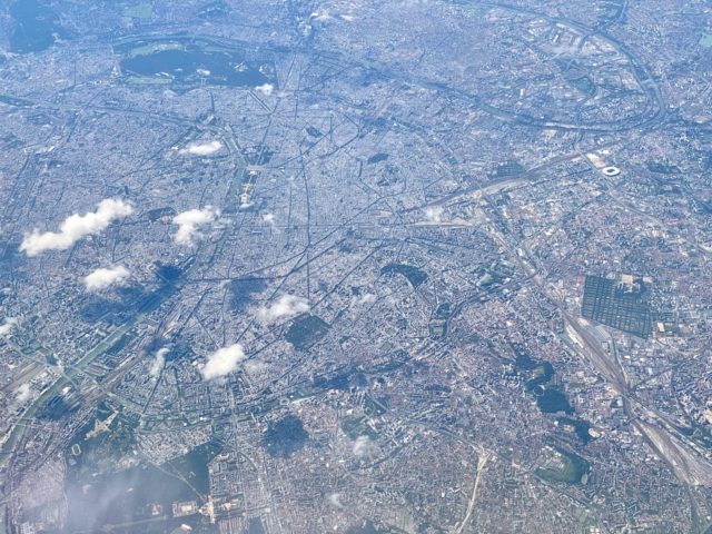
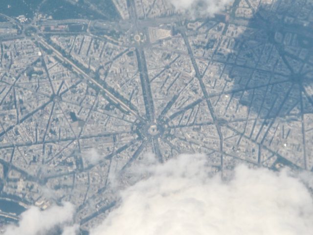
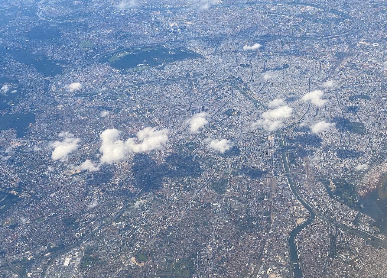
As we flew over Paris, the expansive Charles de Gaulles airport came into view. Moments later, the Stade de France stadium, with its distinctive white roof, in the Parisian suburb of St. Denis was unmistakable. At that moment, we were flying at an altitude of 10,000 meters or 33,000 feet. I zoomed in and took a series of pictures. It was easy to recognise the Arc de Triomphe and the network of boulevards, including the Champs-Elysée leading up to it. In the photo below, you can just about see the Arc de Triomphe, Trocadero and Eiffel Tower.
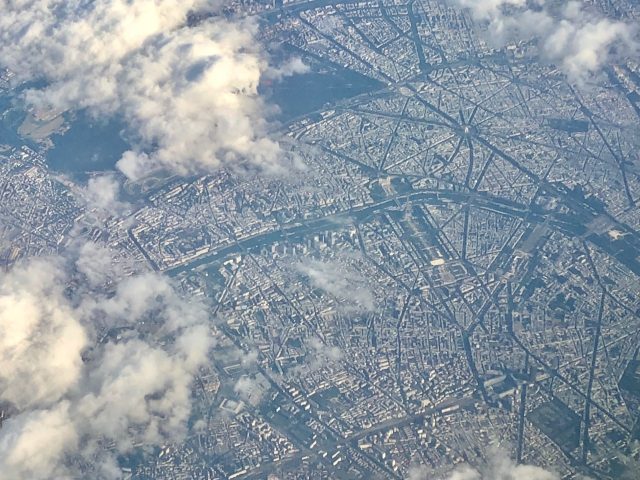
On another flight from Amsterdam to Barcelona, I spotted this view of Paris from the air. I zoomed in a bit for a closer look and I could clearly see the Seine river and the Île de la Cité. The broad Champs Élysée boulevard could also easily be seen, as well as the Arc du Triomphe. Just west of the boulevard, I spotted the Eiffel Tower. Can you spot these iconic landmarks in the photo below?
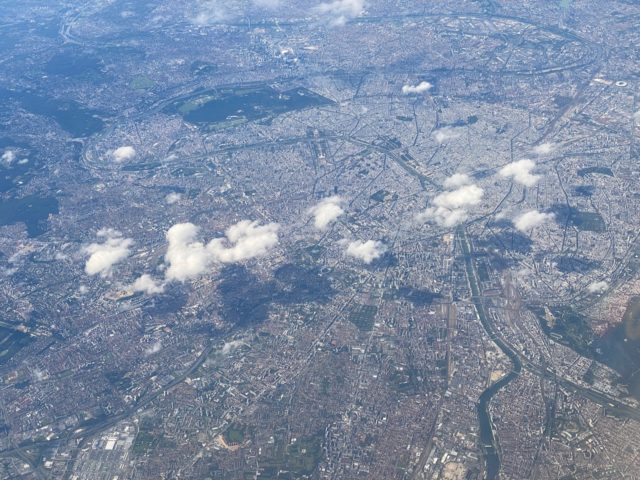
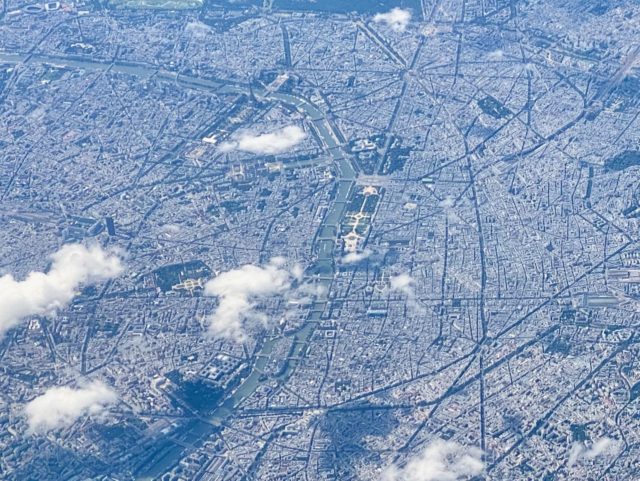
The Île de la Cité is the island in the middle of the photo. Follow the line of the Seine River upwards and you can spot the grounds of the Louvre and the Champs Élysée on the right of the river. At the top of the leftward bend of the Seine, you can see the Eiffel Tower.
As the plane flew further south, Orly Airport, Paris’ second airport, came into view.
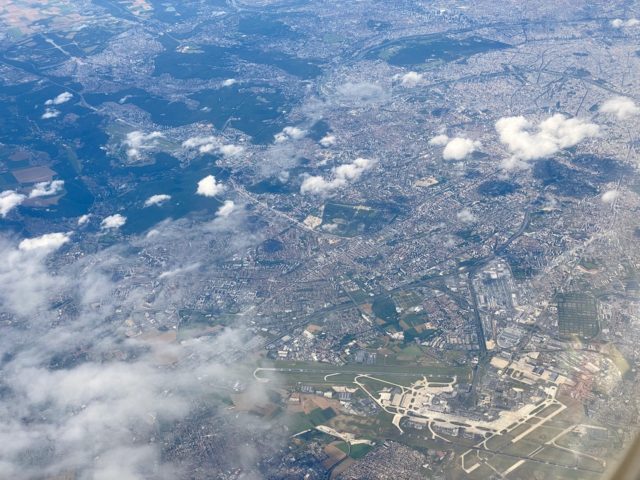
Flying over Paris on a clear day is always a treat and I love trying to spot all these world-famous landmarks!
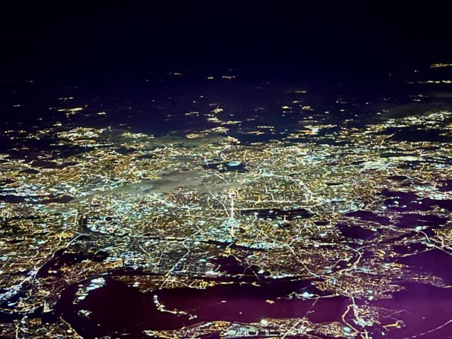
Paris from a plane window by night
Flying over Paris at night is also an amazing experience. It quickly becomes apparent why they call it the ‘City of Lights’. The sparkling mass is an incredible sight. In the photo below, look closer and you might even be able to spot the brightly lit Eiffel Tower.
Read other Plane Views posts:
- Mt. Kinabalu, Sabah, Malaysia
- Atacama desert, Chile
- Kota Kinabalu, Malaysia
- Mt. Vesuvius, Italy
- Mallorca, Spain
- Bora Bora, French Polynesia
- Santiago to Punta Arenas, Chile
- Sydney Harbour, Australia
- Vancouver to Portland, OR



[…] Source […]
[…] trip to Valencia in Spain has been an excellent source of Plane Views posts: there was Paris from the air and a study of the European patchwork of fields. On my flight back to Amsterdam, I […]
[…] The fields grew in size and the landscape was visibly more hilly. The plane flew directly above Paris before continuing in a southerly direction. We flew over towns which clearly formed the epicentre […]
Haha, very funny. 🙂
wait wait.. i can see that restaurant that Marlys blogged about on Cumi & Ciki! 😛 (kidding)
nice one keith!
Oh yea! Now I can see it. Thanks! Oh Eiffel tower..
Feels good just looking at it. 🙂
Hi Juno,
If you look at the second photo, see the Seine river in the bottom left. The Eiffel Tower can be seen at the foot of the first bridge from the left of the photo (the biggest of the two bridges in the photo). 🙂
Cheers,
Keith
Stunning.
I’ve read about city planning of Paris. Spider web-shaped. It’s true! haha
Of course I could recognize in map too, but it’s really good with real pictures.
Thanks for sharing Keith!
Where is Eiffel tower anyways? 😀