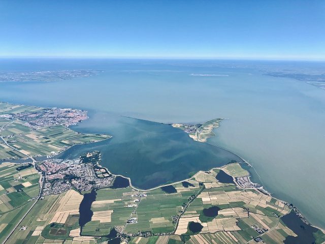
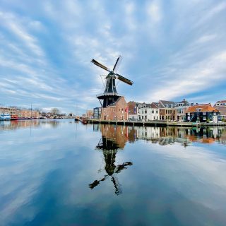
The Markermeer (Marker Lake) is a large 700-square-km (270 sq mi) lake in central Netherlands. A road trip around the Markermeer provides many fascinating insights into the history of the Netherlands; from devastating floods that plagued this region to the rise and fall of powerful trading towns, as well as the need to control water levels and create more land for a burgeoning population. Starting from Amsterdam, the Markermeer loop, a great Netherlands road trip, can be driven in a day but I recommend taking more time (2-3 days) to learn more about the region’s history through the picturesque towns, man-made structures and nature reserves.
How the Dutch created their country
When I first moved to the Netherlands, I often heard (and read) the saying that ‘God created the Earth but the Dutch created Holland’. I found it very intriguing and spurred me to delve into the history of the Netherlands.
The name of the country, Netherlands (‘nether’ or ‘low’ lands), refers to the fact that a significant part of the country is low-lying (i.e. under sea level). In case you were wondering, the name ‘Holland’ that’s commonly used around the world when talking about the Netherlands actually refers to two of the country’s twelve provinces: North Holland (with Amsterdam as its biggest city) and South Holland (Rotterdam).
The struggle of the Dutch over the centuries against encroaching water from the sea and rivers – about one-third of the Netherlands lies below sea level – plays a major role in the country’s history, and if one were to research the national psyche, this aspect is unmissable.
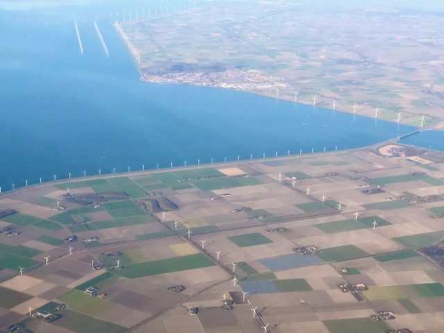
In their fight against flooding, the Dutch constructed an impressive network of canals, sluices, locks, dams, dikes, pumping stations (in the past, windmills were used) and lakes to protect the coast and regulate water levels inland.
By building this network, they were able to drain the water and create new land called ‘polders’ for housing and agriculture. In this sense, the Dutch did create their own country. It also spawned a cutting-edge engineering, dredging and land-reclamation industry that has made the Dutch master builders across the world (with Singapore and Dubai as prime examples).
A brief history of the Markermeer
The Markermeer was originally part of the Zuiderzee (or Southern Sea), a large, shallow bay that had a narrow opening into the North Sea. The bay and the low-lying areas around it were prone to flooding especially during storms. Some of the most devastating floods took place in the 13th century when storm surges ripped through the protective dunes and seawalls along the North Sea coast. These natural disasters widened the opening to the North Sea and increased the size of the bay. This in turn led to the rise of trading towns around the Zuiderzee such as Hoorn, Enkhuizen and Amsterdam. In the 17th century, these towns experienced their heyday as merchant ships laden with goods came from around the world. However, despite the efforts of the Dutch to protect their land, floods continued to persist and these towns remained vulnerable.
The Zuiderzee Works
The Dutch knew that a project of gargantuan proportions was called for to effectively stave off flooding. One of the plans considered was the mammoth task of draining the Zuiderzee. This plan surfaced as far back as the 17th century but it wasn’t until the 20th century that the Zuiderzee Works were launched. This ambitious project involved the damming of the Zuiderzee to protect the coast and extensive land reclamation for housing and agriculture. This incredible engineering feat, along with the equally massive Delta Works in the southwest of the country, is often called one of the Seven Wonders of the Modern World!
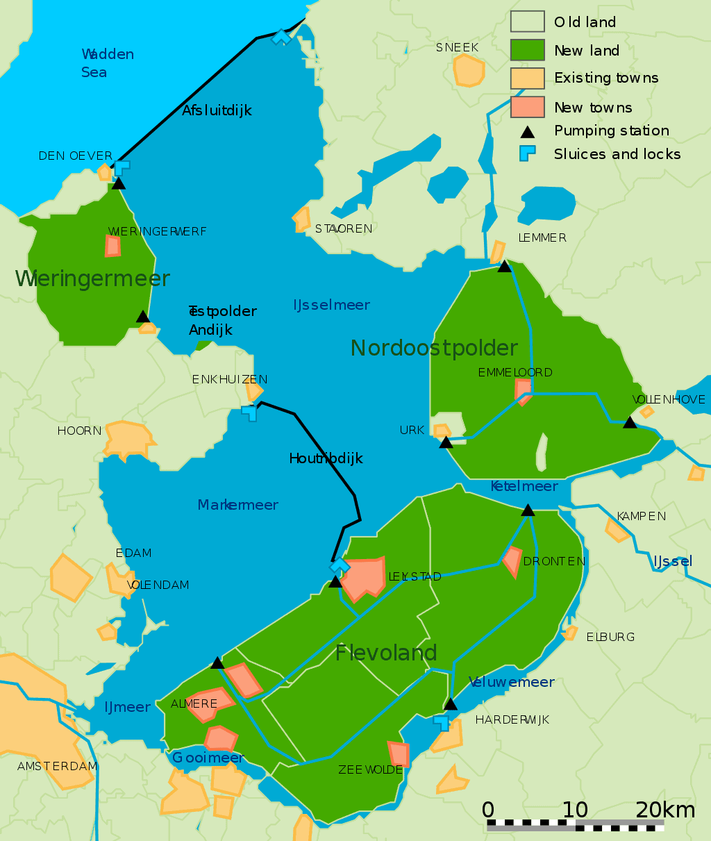
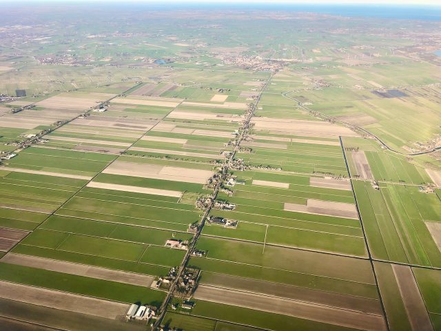
In 1932, the Zuiderzee was closed off to the North Sea with the completion of the Afsluitdijk, a 32km dike that connects the provinces of North Holland and Friesland. At this point, the bay became a lake and was renamed the Ijsselmeer (Ijssel Lake), and the rivers that drained into it gradually turned the salt water into fresh water. In the following decades, a 1,500 square km (580 sq mi) area was reclaimed as new land. The largest chunk became the new province of Flevoland (where almost half a million people now live!).
Houtribdijk
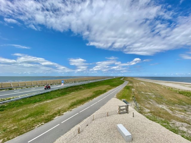
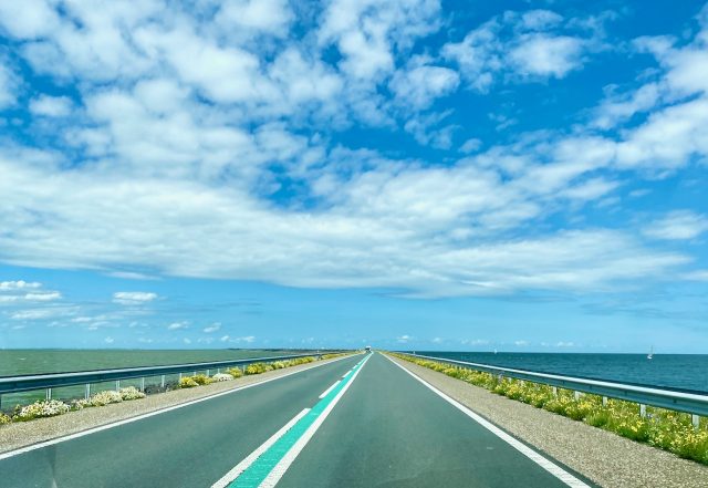
The next stage of the project was to construct a dike connecting the new province, Flevoland, with North Holland across the Ijsselmeer in the west. In 1976, the 27km-long Houtribdijk, a causeway linking the towns of Enkhuizen and Lelystad, was completed, effectively splitting the Ijsselmeer in two. The southern section was renamed the Markermeer.
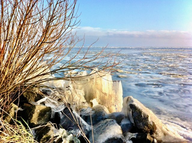
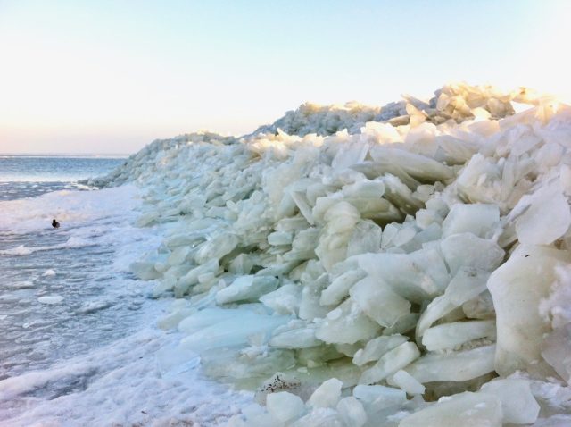
The original intention was to then drain the Markermeer to create more land – one of the ideas was to build a new international airport to replace Amsterdam Schiphol Airport. However, after the completion of the dike, the plan to drain the lake was shelved due to financial and environmental concerns. These days, the lake is a popular recreational area, especially for yachting and windsurfing. It’s also a freshwater reservoir and plays an important role in water management and flood control.
Historical sources: Encyclopedia Brittanica, Wikipedia.
Places to visit around the Markermeer
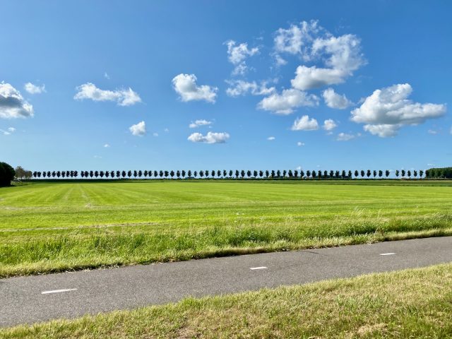
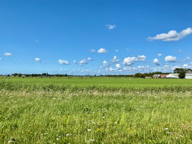
A road trip from Amsterdam around the Markermeer is a great way to explore North Holland and the neighbouring provinces in central Netherlands and learn a lot about the country’s rich history. The Markermeer loop passes many historic towns (some with impressive fortifications), picturesque polder landscapes, quaint villages, and (man-made) nature reserves. The loop can also be combined with a wider North Holland road trip.
This Markermeer guide contains links to three services I often use myself and can recommend: Booking.com (for hotel bookings), Expedia.com (for car hire) and GetYourGuide (for easy-to-book tours). If you make a booking via one of these services, I will receive a small commission (at no extra cost to you). These commissions help me to maintain my blog and share more travel experiences with you.
You can join the Markermeer loop at any point but for the purposes of this post, I’ve chosen Amsterdam as the starting point. Search for flights to Amsterdam with KLM and for a rental car. From Amsterdam, follow the A1 highway southeastwards.
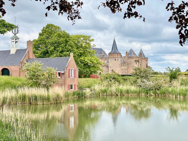
Muiden
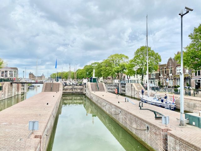
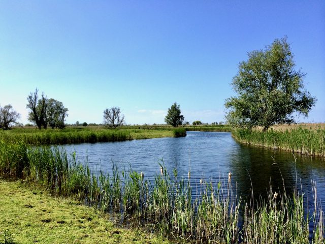
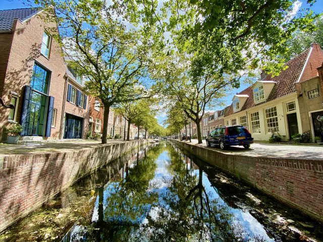
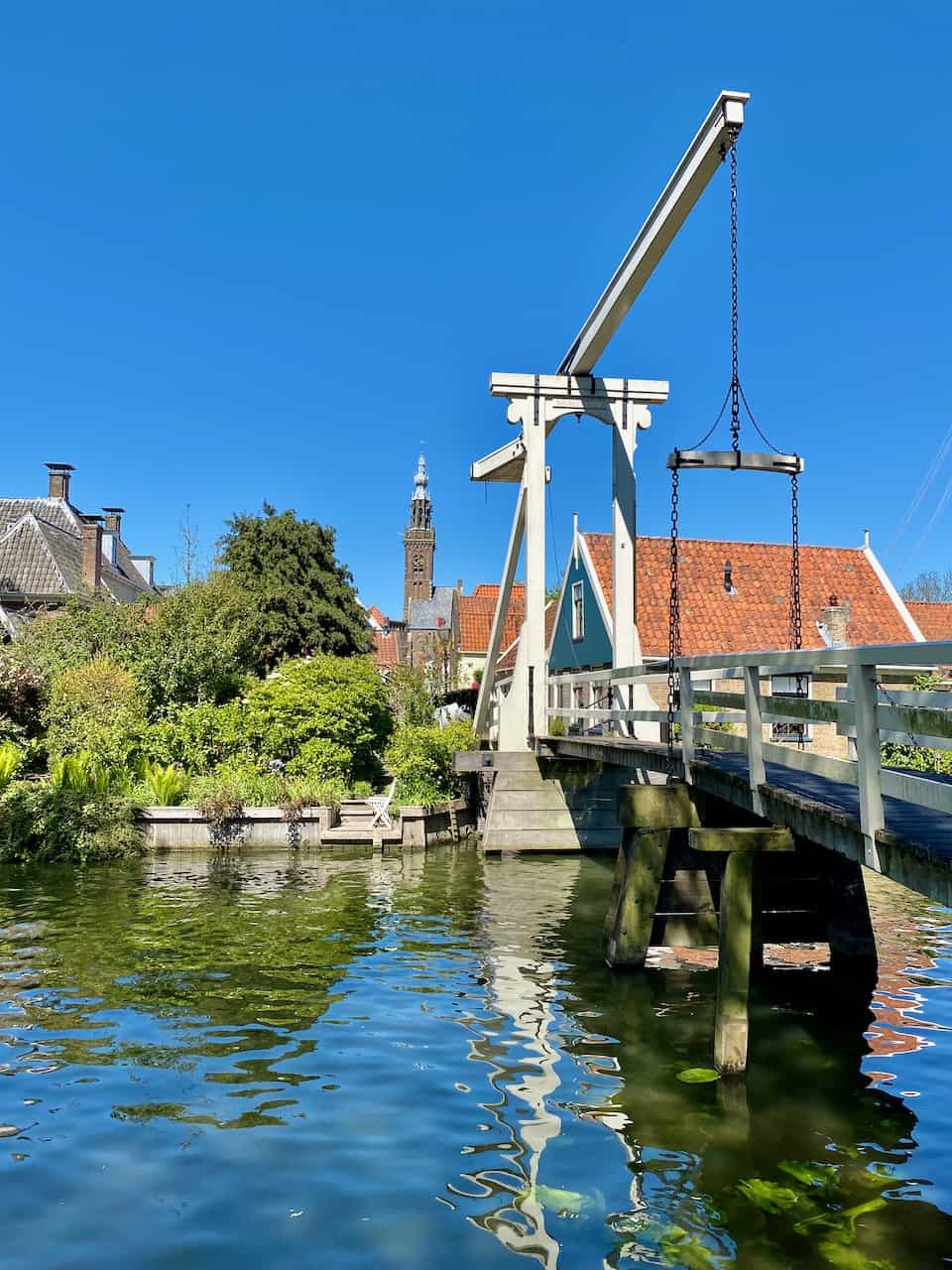
Make Muiden your first stop. Just 15 minutes from Amsterdam, Muiden is a picturesque town with an impressive 13th century castle: Muiderslot. The Vecht River flows through the town and enters the Markermeer via the sluices in the town. The sluices are part of the elaborate network of water management systems around the Markermeer. Don’t miss a visit to the Muiderslot Castle. Another tip: if you love french fries, head to the snack bar at Vestingplein (next to the parking area and Muizenfort Museum) for some superb fries! And if you love cheese, make sure to stock up on some delicious cheeses at the mobile cheese shop across the road.
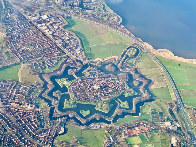
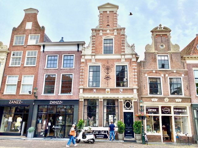
Naarden Vesting
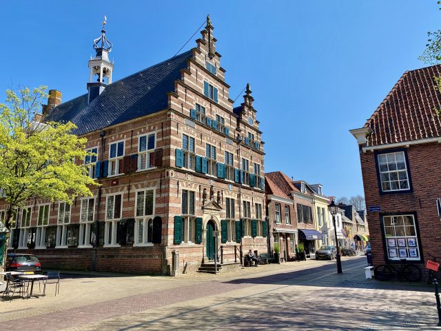
Your next stop (slightly off the route) is the star-shaped fortress town of Naarden Vesting.
Stroll around its historic centre, with its boutiques, antique stores and art galleries. At the centre of the town is the Grote Kerk (Great Church), which is famous across the country for its Matthäus–

Almere
From Naarden Vesting, backtrack along the A1 highway to the A6 highway to Almere. Once you cross the Hollandse Brug (Holland Bridge), you’ll find yourself in the youngest province of the Netherlands: Flevoland, a product of the Zuiderzee Works. Created to relieve Amsterdam of its growing population and to expand agricultural land, Flevoland is nothing short of an engineering marvel! It’s incredible to realise, as you drive through the province, that this vast piece of land is completely man-made. The two largest towns in the province are Almere and Lelystad, both of which are noteworthy examples of modern urban planning. Almere also offers an interesting palette of contemporary architectural styles.
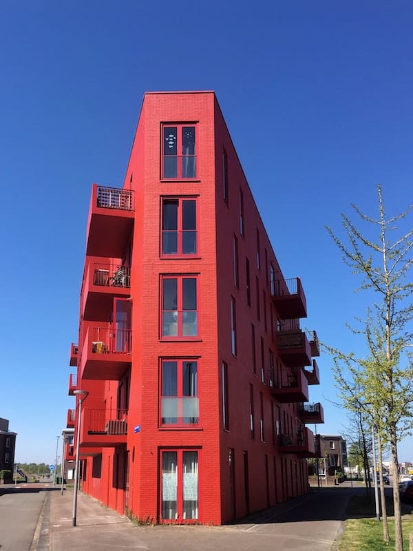
Take the Almere Poort exit from the A6 highway and explore the Almere Poort, Almere Stad and Almere Buiten districts.
Oostvaardersplassen
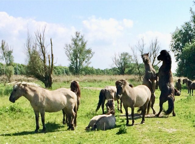
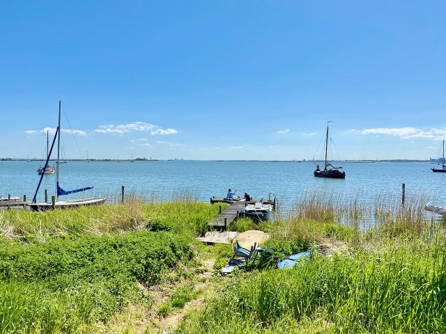
If you’re not into urban planning and modern architecture, I suggest continuing towards the Oostvaardersplassen along the N701 road (Oostvaardersdijk). This road runs along the Markermeer coast of Flevoland and passes one of the most fascinating nature reserves in the country: the Oostvaardersplassen. The youngest national park of the Netherlands, the Oostvaardersplassen is an experiment of wilderness engineering. I recommend dropping by the Visitor Centre for more information as well as maps of walking trails.
The northwest section of the 56 square km reserve comprises wetlands while the southeast consists of grass and woodlands. Since its inception, the reserve has become an important birdlife area, populated by great cormorants, egrets, spoonbills, great bitterns and white-tailed eagles. Konik ponies, red deer and Heck cattle were also introduced and their populations have flourished in the reserve.
Houtribdijk
From the Oostvaardersplassen, follow the N701 road towards the Houtribdijk and Enkhuizen. Completed in 1976, the 27 km-long Houtribdijk is a causeway that links Lelystad in Flevoland with Enkhuizen in North Holland.
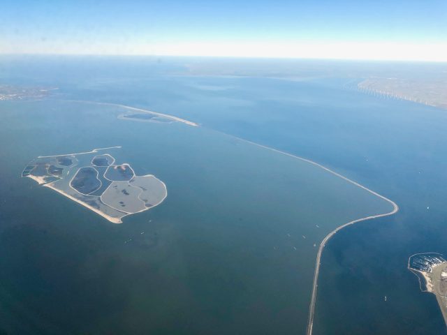
Markerwadden
As plans to drain the Markermeer were shelved, the lake developed into a popular recreational area and is popular for boating, yachting and windsurfing. In recent years, a small archipelago was created, the Markerwadden. These islands were formed as a sanctuary for bird and marine life in the Markermeer, another fascinating experiment in wilderness engineering. The Markerwadden are accessible by a regular boat service from the Bataviahaven (harbour) in Lelystad.
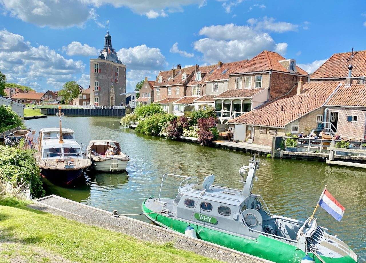
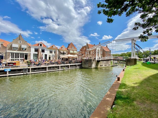
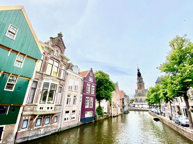
Enkhuizen
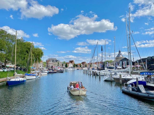
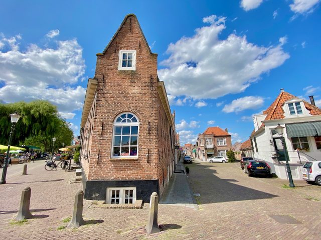
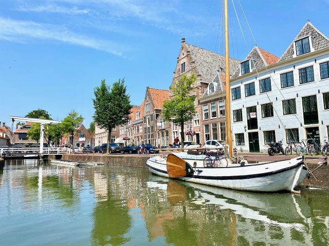
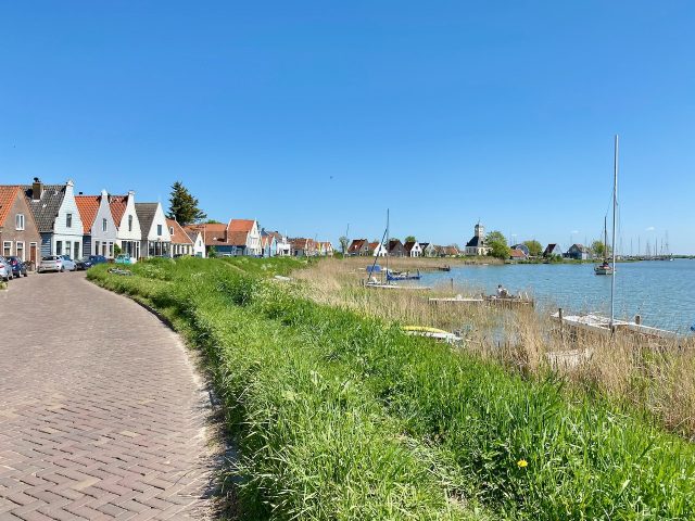
At the end of the Houtribdijk lies the historic town of Enkhuizen. This charming harbour town was one of the richest in the country in the 17th century!
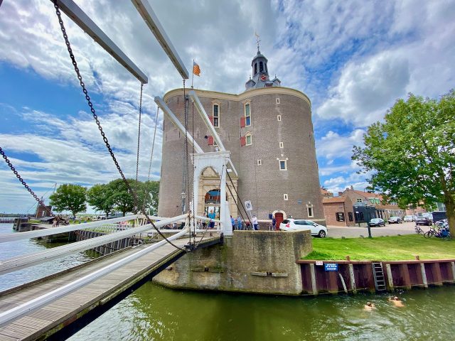
These days, it’s a quiet town that’s popular with yachting enthusiasts – it’s home to the largest yacht marina in the Ijsselmeer. I highly recommend spending some time here (perhaps spend a night or two) to explore the town and learn more about its history. You’ll discover picturesque canals, a lively harbour, beautiful churches and a plethora of cafés and restaurants.
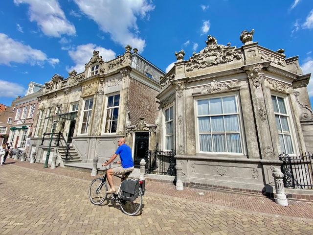
Among the main attractions of Enkhuizen are the 16th century Drommedaris tower (that now houses a cultural centre and bar), the Oude Haven (Old Harbour), the Westerkerk and Zuiderkerk (Western and Southern churches) and the town’s old fortress walls. There’s even a ship-in-a-bottle museum (Flessenscheepjes Museum) with a pretty impressive collection. You can book a guided walking tour of Enkhuizen (which also includes a visit to the Zuiderzee Museum).
To learn more about the region’s history, I recommend a visit to the Zuiderzee Museum. Getting there by boat is a treat in itself! If you’d like to experience sailing on the Ijsselmeer, there’s a regular three-master boat service from Enkhuizen to Urk (a fishing town on what was once an island). From Enkhuizen, there are also boat services to other towns along the Ijsselmeer such as Medemblik and Stavoren (one of the eleven cities to visit in Friesland). For the beer lovers, there are two craft breweries in Enkhuizen: ‘t Ankertje and De Werf, both of which are located at the Oude Haven (Old Harbour). For more info, visit the tourism office.
My personal accommodation favourite in Enkhuizen is the B&B Aan de Haven in the town centre. Or, you can even opt to sleep on a boat in the harbour.
Search for accommodations in Enkhuizen.
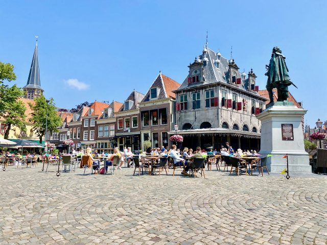
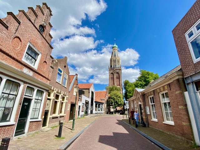
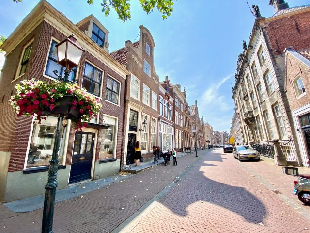
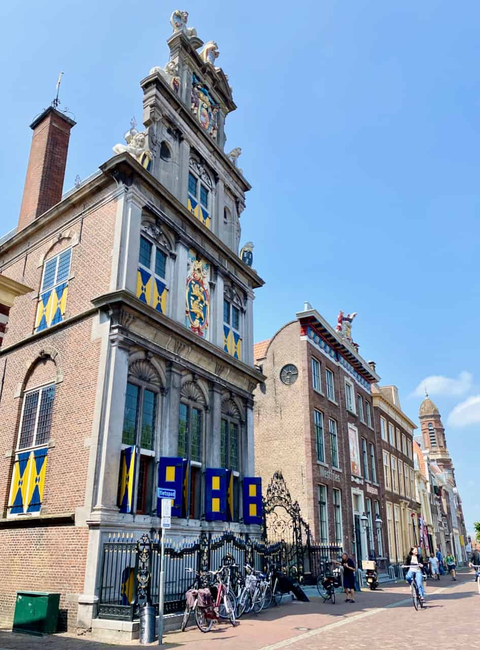
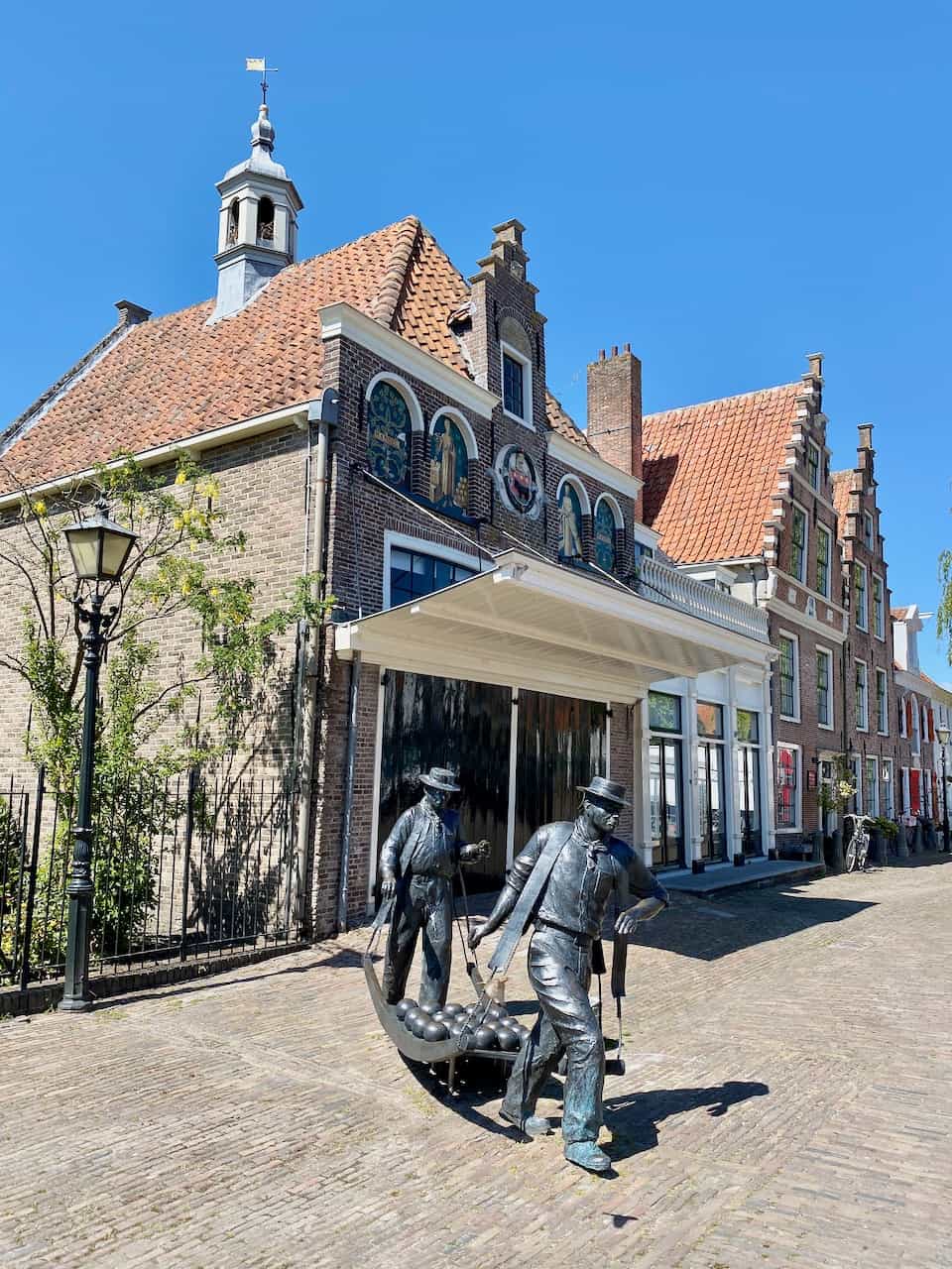
Hoorn
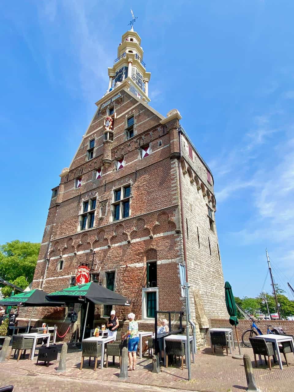
From Enkhuizen, continue to Hoorn, another merchant town that rose to prominence in the 17th century. Hoorn is a lovely town to wander around in. Don’t miss the gorgeous harbourfront, with its beautiful gabled houses and iconic 16th century Hoofdtoren (‘Head Tower’), the Roode Steen square, the Westfries Museum (a wonderful museum full of artifacts from the Dutch Golden Age) and the Oosterpoort (East Gate). For more info, visit the tourism office.
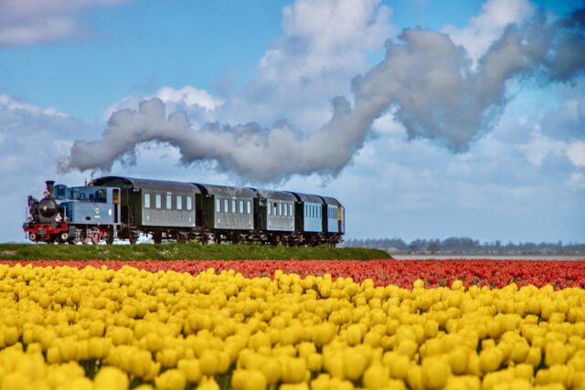
The steam train from Enkhuizen to Hoorn
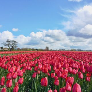
A steam locomotive runs regularly between Hoorn and Enkhuizen via Medemblik, a fun excursion to do. During the tulip months of April and May, a special Tulpentram (Tulip Train) plies this route, offering passengers gorgeous views of the tulip fields.
Beemster polder
From Hoorn, you can choose to deviate from the route to visit the Beemster polder. This polder (land reclaimed for housing and agriculture) was created in the early-17th century. Its grid of canals, dikes and fields exists to this day and is a UNESCO World Heritage site. This region is also famous for its Beemster cheese.
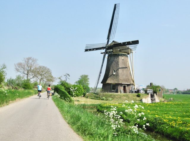
Tulip fields
If you plan to drive the Markermeer loop in spring (April/early-May), you’re in for a treat! There are two major tulip-growing areas near this loop: Flevoland and the ‘Kop van Noord Holland’ (the northern region of the province of North Holland).
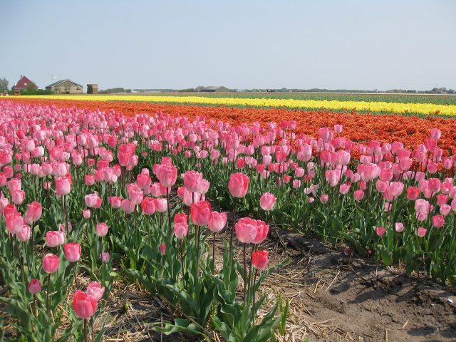
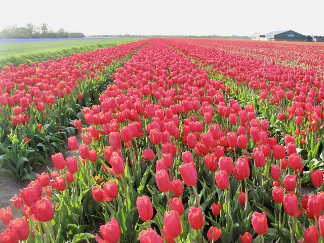
In the ‘Kop van Noord Holland’, head towards the triangle formed by Schagen, Sint Maartensvlotbrug and Callantsoog. The flower fields can be found throughout this region, right up to the North Sea coast. While you’re in the area, you might as well head for the beach! Of the little beach towns that dot this section of the coast, my favourite is Callantsoog.
Alkmaar
Another detour definitely worth making is the historic city of Alkmaar. Famous for its traditional cheese market and medieval architecture, Alkmaar is a great city to explore. Here you’ll find picturesque canals, rows of houses with beautiful gables, lively squares, a plethora of boutiques, antique and art galleries, and ornate churches. Read more about things to see in Alkmaar. You can even extend your itinerary to explore the North Holland countryside just north of Alkmaar.
Search for accommodations in Alkmaar. Join a walking tour of Alkmaar.
Edam
Famous for its cheese, Edam is a must-visit (in my book) not only for its cheeses but for its quaint houses and picturesque canals. A leisurely stroll around its quiet lanes, colourful gardens and cosy squares is a lovely experience.
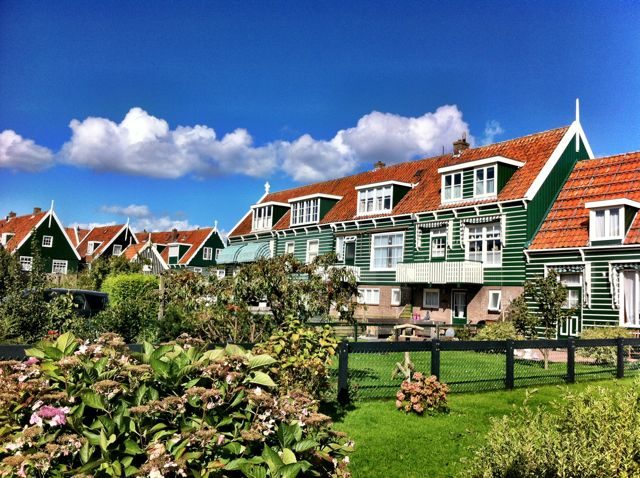
Marken
Marken is a historic fishing village that’s most famous for its wooden houses, many of which were built on stilts. It’s a popular village amongst tourists, who come here to stroll around the picturesque village centre and marina, visit the cheese and wooden shoe factory and have a look inside one of the historic homes. While you’re here, stop at the ‘viskraam’ (fish stall) and try some ‘haring’ (raw herring served with chopped onions) or kibbeling (fried fish nuggets) with remoulade sauce.
From Marken’s harbour, you can take the ferry across the Markermeer to Volendam, another tourist favourite. The ferry ride takes about 20 minutes. Volendam’s harbour is home to beautiful sailboats and is surrounded by quaint homes and shops. There you can explore the colourful town, see the locals, some of whom still wear their traditional costumes, and taste Dutch specialties such as pancakes, ‘poffertjes’ (mini-pancakes), herring and smoked eel.
Back to Amsterdam
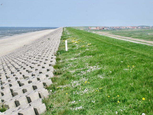
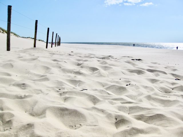
From Marken, I recommend making your way back to Amsterdam via the Uitdammerdijk along the shores of the Markermeer. This road passes beautiful villages, farms and small nature reserves (especially for birdlife).
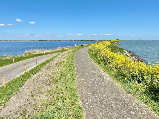
Stop ever so often to climb to the top of the dike for lovely views of the Markermeer. The last village before Amsterdam is Durgerdam. From here, it’s just a short drive into the city.


Thanks Donna for your lovely comment! It’s one of my favourite road trips from Amsterdam. The history of this area is so fascinating!
Cheers,
Keith
This is a great post, Keith. So very interesting and informative. I thought I knew the history of this area fairly well, but you definitely taught me a few things. Very enjoyable and great photos.
Awesome !
[…] often drive the loop which takes me from North Amsterdam past the picturesque village of Durgerdam, along the coast of the Markermeer (a huge lake that’s popular amongst surfing and windsailing enthusiasts) to the island of […]
[…] A drive along the Markermeer loop […]
[…] can also hire a car and drive the Markermeer loop or visit the Hoge Veluwe National […]
[…] Markermeer road trip from Amsterdam […]
[…] Exploring the Markermeer region […]
[…] A road trip along the Markermeer loop […]
[…] Exploring the Markermeer region […]
[…] about a road trip around the Markermeer which also includes this tulip […]
[…] Exploring the Markermeer region […]
Hi Rob, thanks for your lovely comment and fun fact! It’s incredible that this once abandoned land is now a national reserve with a great diversity of nature.
Cheers,
Keith
What a great trip Keith! Again I learn so much more about my own country reading your blog, thanks!
What is a fun fact about the Oostvaardersplassen, the reserve. Is that originally it was created for industry. But there was so much neW land, it was A bit forgotten. And the return of the once disappeared seaeagle (whitetip) in 2006 Was a spectaculair present from mother nature ?
[…] region in North Holland can easily be combined with a broader Holland road trip around the […]
[…] The region north of Amsterdam has many quaint, historic towns which make for a perfect day trip from Amsterdam. During the Dutch Golden Age (17th century), some of these towns such as Volendam and Edam, rose to prominence as important fishing, trading and shipbuilding posts. If you have a car, I recommend driving to Durgerdam, just across the Ij-Harbour, and continuing along the Markermeer coast to the island of Marken (connected to the mainland by a dike). From here, it’s a short drive to the historic towns of Monnickendam, Volendam and Edam (famous for its cheese). You can opt to continue further north to another historic town: Hoorn, which has a beautiful historic centre and is the location of the Westfries Museum (that showcases the Dutch Golden Age). This region can also be explored as part of a road trip around the Markermeer from Amsterdam. […]
[…] Naarden, and is a lovely place to visit. I recommend it as part of a day trip from Amsterdam or a Holland road trip for a stroll around its historic centre, which is full of boutiques, antique stores and art […]
[…] and I can definitely recommend a visit, perhaps as a day trip from Amsterdam or as part of a road trip around the Markermeer. Or you can make Alkmaar your base to visit Amsterdam or explore the surrounding countryside of […]